
Dahlem topographic map
Interactive map
Click on the map to display elevation.
About this map
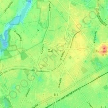
Name: Dahlem topographic map, elevation, terrain.
Location: Dahlem, Steglitz-Zehlendorf, Berlin, 14195, Germany (52.44168 13.24746 52.47053 13.30999)
Average elevation: 50 m
Minimum elevation: 31 m
Maximum elevation: 72 m
Other topographic maps
Click on a map to view its topography, its elevation and its terrain.
Battle of Berlin
Battle of Berlin, Gertrud-Kolmar-Straße, Dorotheenstadt, Mitte, Berlin, 10117, Germany
Average elevation: 39 m
Friedrichshain-Kreuzberg
Friedrichshain-Kreuzberg, Berlin, Germany
Average elevation: 45 m
Charlottenburg-Wilmersdorf
Charlottenburg-Wilmersdorf, Berlin, Germany
Average elevation: 44 m