
Masina topographic map
Interactive map
Click on the map to display elevation.
About this map
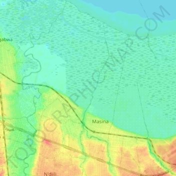
Name: Masina topographic map, elevation, terrain.
Location: Masina, Tshangu, Kinshasa, DR Congo (-4.40595 15.36101 -4.32496 15.42788)
Average elevation: 280 m
Minimum elevation: 264 m
Maximum elevation: 315 m
Other topographic maps
Click on a map to view its topography, its elevation and its terrain.