
Güzelyurt topographic map
Interactive map
Click on the map to display elevation.
About this map
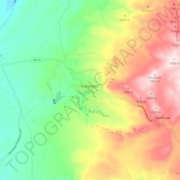
Name: Güzelyurt topographic map, elevation, terrain.
Location: Güzelyurt, Aksaray, Zentralanatolien, Türkei (38.23599 34.33177 38.31599 34.41177)
Average elevation: 1,547 m
Minimum elevation: 1,238 m
Maximum elevation: 1,971 m