
Gunung Kencana topographic map
Interactive map
Click on the map to display elevation.
About this map
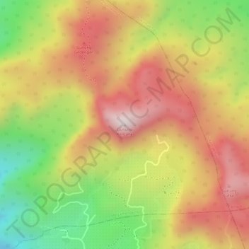
Name: Gunung Kencana topographic map, elevation, terrain.
Location: Gunung Kencana, Bogor, West Java, 16750, Indonesia (-6.65922 106.97939 -6.65912 106.97949)
Average elevation: 1,533 m
Minimum elevation: 1,211 m
Maximum elevation: 1,774 m
Other topographic maps
Click on a map to view its topography, its elevation and its terrain.
Bogor Barat
Bogor Barat, Bogor, West Java, Java, Indonesia
Average elevation: 215 m
Bogor Botanical Gardens
Indonesia > West Java > Bogor > Tegal Gundil
Bogor Botanical Gardens, Tegal Gundil, Bogor, West Java, Indonesia
Average elevation: 256 m
Mount Salak
Mount Salak, Bogor, West Java, Indonesia
Average elevation: 1,770 m