
Weer topographic map
Interactive map
Click on the map to display elevation.
About this map
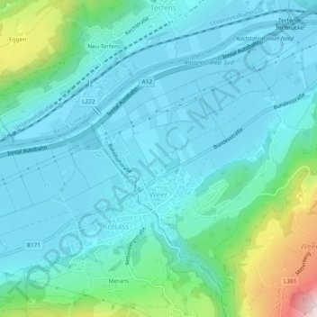
Name: Weer topographic map, elevation, terrain.
Location: Weer, Schwaz, Tyrol, 6116, Austria (47.29372 11.63193 47.32104 11.67882)
Average elevation: 623 m
Minimum elevation: 538 m
Maximum elevation: 1,015 m