
Zell am Ziller topographic map
Interactive map
Click on the map to display elevation.
About this map
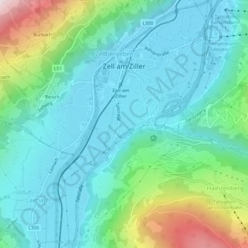
Name: Zell am Ziller topographic map, elevation, terrain.
Location: Zell am Ziller, Bezirk Schwaz, Austria (47.21130 11.86935 47.24170 11.89784)
Average elevation: 744 m
Minimum elevation: 565 m
Maximum elevation: 1,359 m
Other topographic maps
Click on a map to view its topography, its elevation and its terrain.