Île de l'Amiante topographic map
Interactive map
Click on the map to display elevation.
About this map
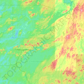
Name: Île de l'Amiante topographic map, elevation, terrain.
Average elevation: 415 m
Minimum elevation: 362 m
Maximum elevation: 618 m

Click on the map to display elevation.
Name: Île de l'Amiante topographic map, elevation, terrain.
Average elevation: 415 m
Minimum elevation: 362 m
Maximum elevation: 618 m