
Harrisburg topographic map
Interactive map
Click on the map to display elevation.
About this map
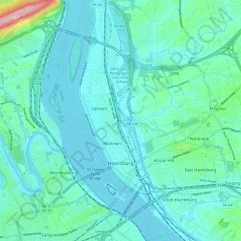
Name: Harrisburg topographic map, elevation, terrain.
Location: Harrisburg, Dauphin County, Pennsylvania, United States (40.23757 -76.92449 40.32629 -76.83686)
Average elevation: 122 m
Minimum elevation: 87 m
Maximum elevation: 340 m
Other topographic maps
Click on a map to view its topography, its elevation and its terrain.
Paxtonia
United States > Pennsylvania > Dauphin County > Lower Paxton Township
Paxtonia, Lower Paxton Township, Dauphin County, Pennsylvania, United States
Average elevation: 151 m
Lawrence Park
United States > Pennsylvania > Dauphin County > Linglestown > Lawrence Park
Lawrence Park, Linglestown, Dauphin County, Pennsylvania, 17112, United States
Average elevation: 167 m