
Węgorzewo topographic map
Interactive map
Click on the map to display elevation.
About this map
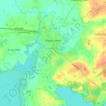
Name: Węgorzewo topographic map, elevation, terrain.
Average elevation: 123 m
Minimum elevation: 107 m
Maximum elevation: 151 m
Other topographic maps
Click on a map to view its topography, its elevation and its terrain.
Sztynort
Poland > Warmian-Masurian Voivodeship > Węgorzewo County > Sztynort
Sztynort, gmina Węgorzewo, Węgorzewo County, Warmian-Masurian Voivodeship, 11-600, Poland
Average elevation: 117 m