
Fulda topographic map
Interactive map
Click on the map to display elevation.
About this map
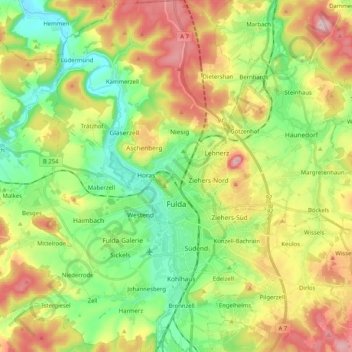
Name: Fulda topographic map, elevation, terrain.
Location: Fulda, Landkreis Fulda, Hesse, Germany (50.49954 9.56614 50.62941 9.73298)
Average elevation: 324 m
Minimum elevation: 225 m
Maximum elevation: 470 m
Other topographic maps
Click on a map to view its topography, its elevation and its terrain.
Ehrenberg
Germany > Hesse > Landkreis Fulda
Ehrenberg, Landkreis Fulda, Hesse, Germany
Average elevation: 708 m