
Riverton topographic map
Interactive map
Click on the map to display elevation.
About this map
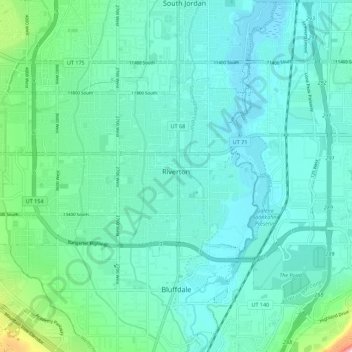
Name: Riverton topographic map, elevation, terrain.
Location: Riverton, Salt Lake County, Utah, 84065, United States (40.49314 -112.02448 40.54068 -111.91373)
Average elevation: 1,376 m
Minimum elevation: 1,315 m
Maximum elevation: 1,694 m