
Pico El Águila topographic map
Interactive map
Click on the map to display elevation.
About this map
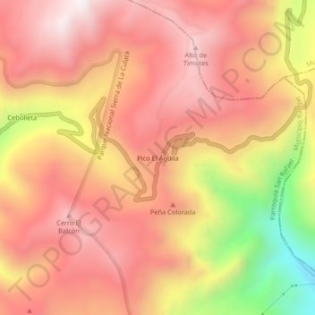
Name: Pico El Águila topographic map, elevation, terrain.
Average elevation: 3,959 m
Minimum elevation: 3,306 m
Maximum elevation: 4,308 m
Other topographic maps
Click on a map to view its topography, its elevation and its terrain.
Río Canaguá
Venezuela > Estado Mérida > Municipio Rangel
Río Canaguá, Parroquia Rangel, Municipio Rangel, Estado Mérida, Venezuela
Average elevation: 3,294 m
Quebrada Mucuñuque
Venezuela > Estado Mérida > Municipio Rangel
Quebrada Mucuñuque, Parroquia San Rafael, Municipio Rangel, Estado Mérida, Venezuela
Average elevation: 3,400 m