
下閉伊郡 topographic map
Interactive map
Click on the map to display elevation.
About this map
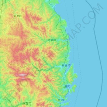
Name: 下閉伊郡 topographic map, elevation, terrain.
Location: 下閉伊郡, Préfecture d'Iwate, Tōhoku, Japon (39.29855 141.39483 40.16524 142.32413)
Average elevation: 340 m
Minimum elevation: 0 m
Maximum elevation: 1,875 m
Other topographic maps
Click on a map to view its topography, its elevation and its terrain.