
Uhy topographic map
Interactive map
Click on the map to display elevation.
About this map
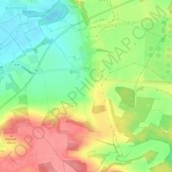
Name: Uhy topographic map, elevation, terrain.
Location: Uhy, okres Kladno, Central Bohemia, Czechia (50.26534 14.25337 50.29647 14.29543)
Average elevation: 223 m
Minimum elevation: 179 m
Maximum elevation: 275 m
Other topographic maps
Click on a map to view its topography, its elevation and its terrain.
Brdy
Czechia > Central Bohemia > Obecnice
Brdy, Obecnice, okres Příbram, Central Bohemia, Czechia
Average elevation: 782 m
Stradonice
Czechia > Central Bohemia > Stradonice
Stradonice, okres Kladno, Středočeský kraj, Central Bohemia, Czechia
Average elevation: 268 m
Brdy
Czechia > Central Bohemia > Obecnice
Brdy, Obecnice, okres Příbram, Středočeský kraj, Central Bohemia, Czechia
Average elevation: 794 m
Dolní Břežany
Czechia > Central Bohemia > Dolní Břežany
Dolní Břežany, okres Praha-západ, Středočeský kraj, Central Bohemia, Czechia
Average elevation: 352 m
Beroun
Czechia > Central Bohemia > Beroun
Beroun, okres Beroun, Středočeský kraj, Central Bohemia, Czechia
Average elevation: 318 m
CHKO Křivoklátsko
Czechia > Central Bohemia > Nezabudice
CHKO Křivoklátsko, 201, Nezabudice, okres Rakovník, Středočeský kraj, Central Bohemia, 27023, Czechia
Average elevation: 400 m