
Jeffersonville topographic map
Interactive map
Click on the map to display elevation.
About this map
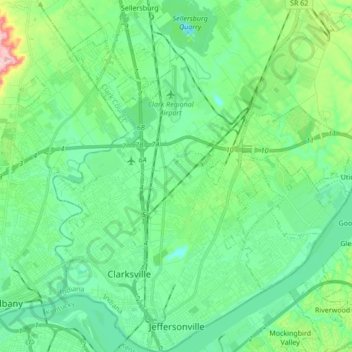
Name: Jeffersonville topographic map, elevation, terrain.
Location: Jeffersonville, Clark County, Indiana, 47130, United States (38.26698 -85.75797 38.40081 -85.63384)
Average elevation: 150 m
Minimum elevation: 103 m
Maximum elevation: 306 m