
Neuchâtel topographic map
Interactive map
Click on the map to display elevation.
About this map
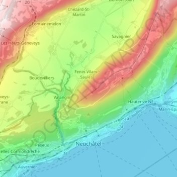
Name: Neuchâtel topographic map, elevation, terrain.
Location: Neuchâtel, Switzerland (46.97784 6.84515 47.06382 6.99177)
Average elevation: 722 m
Minimum elevation: 422 m
Maximum elevation: 1,359 m
Other topographic maps
Click on a map to view its topography, its elevation and its terrain.
Valangin
Switzerland > Neuchâtel > Neuchâtel
Valangin, Neuchâtel, 2042, Switzerland
Average elevation: 756 m