
Kecamatan Seberang Kota topographic map
Interactive map
Click on the map to display elevation.
About this map
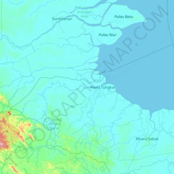
Name: Kecamatan Seberang Kota topographic map, elevation, terrain.
Location: Kecamatan Seberang Kota, Jambi, Indonesia (-1.46574 102.70695 -0.18574 103.98695)
Average elevation: 17 m
Minimum elevation: -2 m
Maximum elevation: 486 m
Other topographic maps
Click on a map to view its topography, its elevation and its terrain.
Berbak National Park
Indonesia > Jambi > Tanjung Jabung Timur
Berbak National Park, Tanjung Jabung Timur, Jambi, Sumatra, Indonesia
Average elevation: 7 m
Kerinci Seblat National Park
Kerinci Seblat National Park, Jambi, Indonesia
Average elevation: 339 m
Mount Kerinci
Indonesia > Jambi > Sungai Penuh
Mount Kerinci, Sungai Penuh, Kecamatan Serai Serumpun, Jambi, Indonesia
Average elevation: 3,229 m