
Gadsden topographic map
Interactive map
Click on the map to display elevation.
About this map
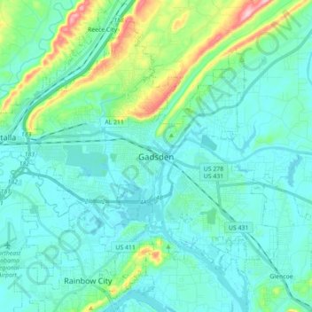
Name: Gadsden topographic map, elevation, terrain.
Location: Gadsden, Etowah County, Alabama, United States (33.94653 -86.11124 34.07933 -85.93460)
Average elevation: 188 m
Minimum elevation: 150 m
Maximum elevation: 376 m
Other topographic maps
Click on a map to view its topography, its elevation and its terrain.
Attalla
United States > Alabama > Etowah County
Attalla, Etowah County, Alabama, United States
Average elevation: 176 m