
Heraklion topographic map
Interactive map
Click on the map to display elevation.
About this map
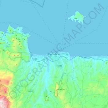
Name: Heraklion topographic map, elevation, terrain.
Average elevation: 175 m
Minimum elevation: -1 m
Maximum elevation: 1,836 m
Other topographic maps
Click on a map to view its topography, its elevation and its terrain.
Petrokefalo
Greece > Region of Crete > Heraklion Regional Unit > Gorgolaini Municipal Unit
Petrokefalo, Gorgolaini Municipal Unit, Municipality of Heraklion, Heraklion Regional Unit, Region of Crete, 700 03, Greece
Average elevation: 249 m