
Knife River topographic map
Interactive map
Click on the map to display elevation.
About this map
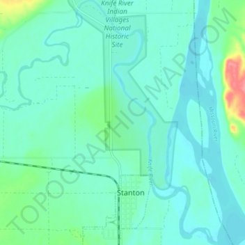
Name: Knife River topographic map, elevation, terrain.
Location: Knife River, Mercer County, North Dakota, USA (47.31062 -101.42107 47.35972 -101.35317)
Average elevation: 519 m
Minimum elevation: 505 m
Maximum elevation: 583 m
Other topographic maps
Click on a map to view its topography, its elevation and its terrain.
Boundary Lake
Boundary Lake, 23rd Avenue Northeast, Bottineau County, North Dakota, USA
Average elevation: 685 m
Hobart Lake
USA > North Dakota > Sanborn
Hobart Lake, 33rd Street Southeast, Sanborn, Barnes County, North Dakota, 58480, USA
Average elevation: 435 m
Rock Lake
USA > North Dakota > Rock Lake
Rock Lake, Towner County, North Dakota, USA
Average elevation: 472 m