
Sugar Lake topographic map
Interactive map
Click on the map to display elevation.
About this map
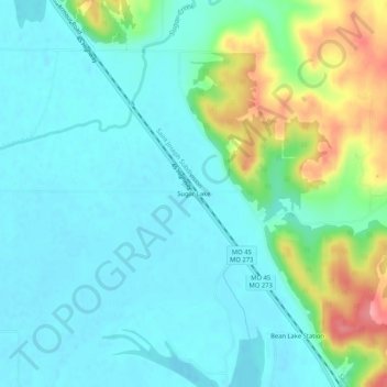
Name: Sugar Lake topographic map, elevation, terrain.
Location: Sugar Lake, Platte County, Missouri, 64484, United States (39.49250 -95.03802 39.53250 -94.99802)
Average elevation: 259 m
Minimum elevation: 234 m
Maximum elevation: 336 m