
Mirande topographic map
Interactive map
Click on the map to display elevation.
About this map
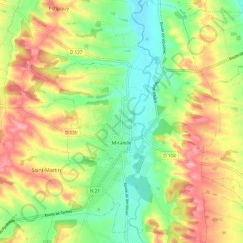
Name: Mirande topographic map, elevation, terrain.
Location: Mirande, Gers, Occitania, Metropolitan France, 32300, France (43.48739 0.36015 43.55258 0.45046)
Average elevation: 198 m
Minimum elevation: 143 m
Maximum elevation: 265 m