
Schiphol topographic map
Interactive map
Click on the map to display elevation.
About this map
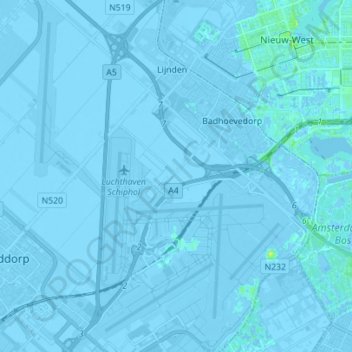
Name: Schiphol topographic map, elevation, terrain.
Location: Schiphol, Haarlemmermeer, North Holland, Netherlands (52.28294 4.70592 52.36801 4.81708)
Average elevation: -2 m
Minimum elevation: -8 m
Maximum elevation: 11 m
Other topographic maps
Click on a map to view its topography, its elevation and its terrain.
Schellingwoude
Netherlands > North Holland > Amsterdam
Schellingwoude, Amsterdam, North Holland, Netherlands, 1023 NH, Netherlands
Average elevation: 1 m
Oosterwijzend
Netherlands > North Holland > Hoogkarspel
Oosterwijzend, Hoogkarspel, Drechterland, North Holland, Netherlands, 1616 CN, Netherlands
Average elevation: -2 m
Purmerend
Netherlands > North Holland > Purmerend
Purmerend, North Holland, Netherlands
Average elevation: -2 m
Den Burg
Den Burg, Texel, North Holland, Netherlands
Average elevation: 1 m
Amsterdam
Netherlands > North Holland > Amsterdam
Amsterdam, North Holland, Netherlands, 1012JS, Netherlands
Average elevation: -1 m
Zandvoort
Netherlands > North Holland > Zandvoort
Zandvoort, North Holland, Netherlands
Average elevation: 4 m
Limmen
Netherlands > North Holland > Castricum > Limmen
Limmen, Castricum, North Holland, Netherlands
Average elevation: 1 m
Middenmeer
Netherlands > North Holland > Middenmeer
Middenmeer, Hollands Kroon, North Holland, Netherlands
Average elevation: -3 m
't Kruis
Netherlands > North Holland > Heerhugowaard > 't Kruis
't Kruis, Heerhugowaard, North Holland, Netherlands, 1703, Netherlands
Average elevation: -2 m
Vondelpark
Netherlands > North Holland > Amsterdam
Vondelpark, Amsterdam, North Holland, Netherlands
Average elevation: 5 m
Bergen (NH)
Netherlands > North Holland > Bergen (NH)
Bergen (NH), North Holland, Netherlands
Average elevation: 4 m
IJmuiden
Netherlands > North Holland > Velsen
IJmuiden, Velsen, North Holland, Netherlands
Average elevation: 5 m
Velserbroek
Netherlands > North Holland > Velsen
Velserbroek, Velsen, North Holland, Netherlands
Average elevation: 3 m
Haarlemmermeer
Haarlemmermeer, North Holland, Netherlands
Average elevation: 0 m