
Malaita Province topographic map
Interactive map
Click on the map to display elevation.
About this map
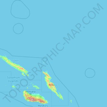
Name: Malaita Province topographic map, elevation, terrain.
Location: Malaita Province, Solomon Islands (-10.06705 158.98086 -4.81085 163.15248)
Average elevation: 12 m
Minimum elevation: 0 m
Maximum elevation: 2,113 m
Other topographic maps
Click on a map to view its topography, its elevation and its terrain.
Sikaiana
Solomon Islands > Malaita Province
Sikaiana, Malaita Province, Solomon Islands
Average elevation: 0 m