
Picanoc River topographic map
Interactive map
Click on the map to display elevation.
About this map
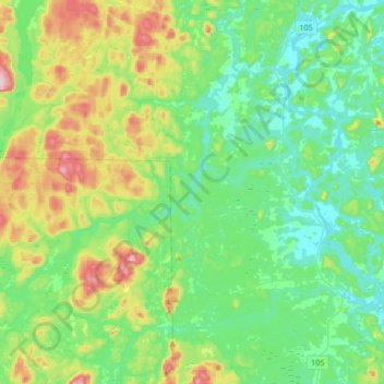
Name: Picanoc River topographic map, elevation, terrain.
Average elevation: 207 m
Minimum elevation: 139 m
Maximum elevation: 389 m
Other topographic maps
Click on a map to view its topography, its elevation and its terrain.
Cawood
Canada > Quebec > Alleyn-et-Cawood
Cawood, Alleyn-et-Cawood, Pontiac (MRC), Outaouais, Quebec, Canada
Average elevation: 229 m