
Esch-sur-Alzette topographic map
Interactive map
Click on the map to display elevation.
About this map
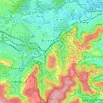
Name: Esch-sur-Alzette topographic map, elevation, terrain.
Location: Esch-sur-Alzette, Canton Esch-sur-Alzette, Luxembourg (49.46091 5.94321 49.51862 6.00514)
Average elevation: 332 m
Minimum elevation: 274 m
Maximum elevation: 436 m