
Dayr Hafir topographic map
Interactive map
Click on the map to display elevation.
About this map
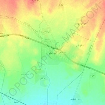
Name: Dayr Hafir topographic map, elevation, terrain.
Location: Dayr Hafir, Manbij, Aleppo Governorate, Syria (36.11202 37.63235 36.19202 37.71235)
Average elevation: 344 m
Minimum elevation: 323 m
Maximum elevation: 368 m