
Silver City topographic map
Interactive map
Click on the map to display elevation.
About this map
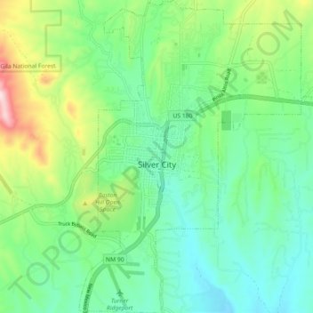
Name: Silver City topographic map, elevation, terrain.
Average elevation: 1,850 m
Minimum elevation: 1,733 m
Maximum elevation: 2,135 m
Other topographic maps
Click on a map to view its topography, its elevation and its terrain.
City of Rocks State Park
United States > New Mexico > Grant County
City of Rocks State Park, Grant County, New Mexico, United States
Average elevation: 1,596 m