Geolocate

Corbeil topographic map

Interactive map

Click on the map to display elevation.

About this map

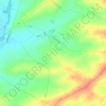
Name: Corbeil topographic map, elevation, terrain.

Location: Corbeil, Vitry-le-François, Marne, Grand Est, Metropolitan France, 51320, France (48.55327 4.40922 48.59056 4.46369)

Average elevation: 137 m

Minimum elevation: 112 m

Maximum elevation: 169 m

Other topographic maps

Click on a map to view its topography, its elevation and its terrain.

Brunette

France > Grand Est > Marne > Merfy

Brunette, Merfy, Reims, Marne, Grand Est, Metropolitan France, 51220, France

Average elevation: 139 m

Saint-Gilles

France > Grand Est > Marne

Saint-Gilles, Reims, Marne, Grand Est, Metropolitan France, 51170, France

Average elevation: 118 m

Péas

France > Grand Est > Marne > Péas

Péas, Épernay, Marne, Grand Est, Metropolitan France, 51120, France

Average elevation: 133 m