
Fusagasugá topographic map
Interactive map
Click on the map to display elevation.
About this map
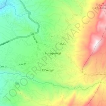
Name: Fusagasugá topographic map, elevation, terrain.
Location: Fusagasugá, Sumapaz, Cundinamarca, 252212, Colombia (4.29692 -74.40449 4.37692 -74.32449)
Average elevation: 1,790 m
Minimum elevation: 1,272 m
Maximum elevation: 2,619 m
It was founded in 1592 by Spanish priests. The town located some 56 kilometers from the capital, Bogotá; borders Pasca, Arbeláez, Tibacuy, Silvania and other municipalities of Sumapaz. Its elevation is 5,669 feet (1,728 m) above sea level, and the average temperature 20 °C (68 °F).