
Santa Fe topographic map
Interactive map
Click on the map to display elevation.
About this map
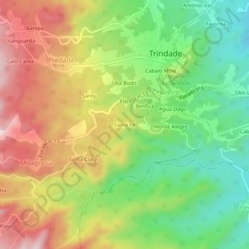
Name: Santa Fe topographic map, elevation, terrain.
Location: Santa Fe, Mé-Zóchi, São Tomé Province, São Tomé and Príncipe (0.26543 6.65449 0.30543 6.69449)
Average elevation: 344 m
Minimum elevation: 164 m
Maximum elevation: 557 m