
Black Lake topographic map
Interactive map
Click on the map to display elevation.
About this map
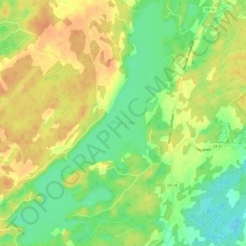
Name: Black Lake topographic map, elevation, terrain.
Average elevation: 148 m
Minimum elevation: 126 m
Maximum elevation: 166 m
Other topographic maps
Click on a map to view its topography, its elevation and its terrain.
Otty Lake
Canada > Ontario > Tay Valley
Otty Lake, MacGowan Lane, Tay Valley, Lanark County, Ontario, Canada
Average elevation: 139 m
Fall River
Canada > Ontario > Tay Valley
Fall River, Tay Valley, Lanark County, Eastern Ontario, Ontario, Canada
Average elevation: 180 m
Little Silver Lake
Canada > Ontario > Tay Valley
Little Silver Lake, Silvery Lane, Tay Valley, Lanark County, Ontario, Canada
Average elevation: 198 m