
Eagle Nest topographic map
Interactive map
Click on the map to display elevation.
About this map
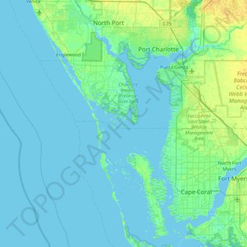
Name: Eagle Nest topographic map, elevation, terrain.
Location: Eagle Nest, Charlotte County, Florida, United States (26.46229 -82.51148 27.10229 -81.87148)
Average elevation: 3 m
Minimum elevation: -1 m
Maximum elevation: 16 m
Other topographic maps
Click on a map to view its topography, its elevation and its terrain.
Rotonda West
United States > Florida > Charlotte County
Rotonda West, Charlotte County, Florida, 33947, United States
Average elevation: 3 m
Punta Gorda
United States > Florida > Charlotte County
Punta Gorda, Charlotte County, Florida, United States
Average elevation: 3 m
Port Charlotte
United States > Florida > Charlotte County
Port Charlotte, Charlotte County, Florida, United States
Average elevation: 4 m
Harbour Heights
United States > Florida > Charlotte County > Deep Creek
Harbour Heights, Deep Creek, Charlotte County, Florida, 33983, United States
Average elevation: 4 m