
Juja topographic map
Interactive map
Click on the map to display elevation.
About this map
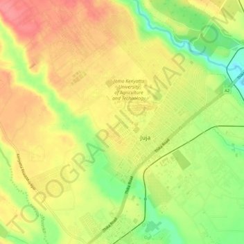
Name: Juja topographic map, elevation, terrain.
Location: Juja, Kiambu, Central Kenya, Kenya (-1.12467 36.99280 -1.07210 37.04172)
Average elevation: 1,516 m
Minimum elevation: 1,465 m
Maximum elevation: 1,550 m
Other topographic maps
Click on a map to view its topography, its elevation and its terrain.