
Frampton topographic map
Interactive map
Click on the map to display elevation.
About this map
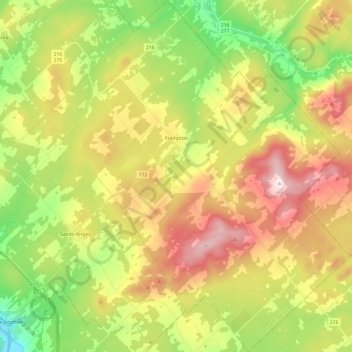
Name: Frampton topographic map, elevation, terrain.
Average elevation: 373 m
Minimum elevation: 141 m
Maximum elevation: 657 m
Other topographic maps
Click on a map to view its topography, its elevation and its terrain.
Vallée-Jonction
Canada > Quebec > La Nouvelle-Beauce
Vallée-Jonction, La Nouvelle-Beauce, Chaudière-Appalaches, Quebec, G0S 3J0, Canada
Average elevation: 243 m
Saint-Isidore
Canada > Quebec > La Nouvelle-Beauce
Saint-Isidore, La Nouvelle-Beauce, Chaudière-Appalaches, Quebec, G0S 2S0, Canada
Average elevation: 144 m