
Olst topographic map
Interactive map
Click on the map to display elevation.
About this map
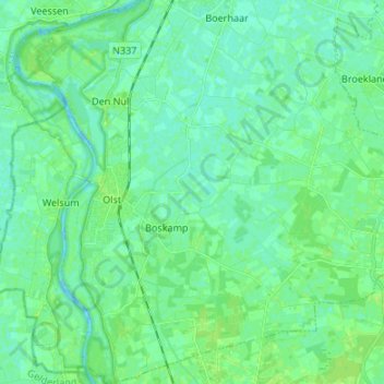
Name: Olst topographic map, elevation, terrain.
Location: Olst, Olst-Wijhe, Overijssel, Niederlande (52.29763 6.07744 52.37954 6.18927)
Average elevation: 4 m
Minimum elevation: -4 m
Maximum elevation: 10 m
Other topographic maps
Click on a map to view its topography, its elevation and its terrain.
Olst-Wijhe
Niederlande > Overijssel > Olst-Wijhe
Olst-Wijhe, Overijssel, Niederlande
Average elevation: 6 m
Wijhe
Niederlande > Overijssel > Olst-Wijhe
Wijhe, Olst-Wijhe, Overijssel, Niederlande
Average elevation: 3 m