
Northampton topographic map
Interactive map
Click on the map to display elevation.
About this map
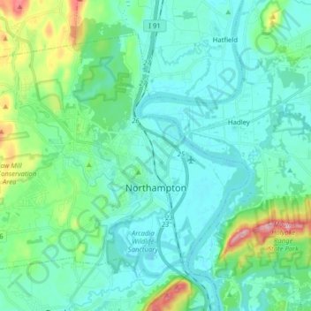
Name: Northampton topographic map, elevation, terrain.
Location: Northampton, Hampshire County, Massachusetts, United States (42.28414 -72.74122 42.37525 -72.58410)
Average elevation: 71 m
Minimum elevation: 25 m
Maximum elevation: 275 m
Other topographic maps
Click on a map to view its topography, its elevation and its terrain.
Swift River
United States > Massachusetts > Hampshire County > Belchertown
Swift River, Belchertown, Hampshire County, Massachusetts, United States
Average elevation: 160 m
Amherst
United States > Massachusetts > Hampshire County
Amherst, Hampshire County, Massachusetts, United States
Average elevation: 120 m