
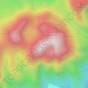
Mt. Cuernos de Negros (Talinis) topographic map
Interactive map
Click on the map to display elevation.
About this map
Name: Mt. Cuernos de Negros (Talinis) topographic map, elevation, terrain.
Average elevation: 1,479 m
Minimum elevation: 998 m
Maximum elevation: 1,823 m
Other topographic maps
Click on a map to view its topography, its elevation and its terrain.
Piapi
Philippines > Negros Oriental > Dumaguete
Piapi, Dumaguete, Negros Oriental, Central Visayas, Philippines
Average elevation: 10 m
Dumaguete
Philippines > Negros Oriental > Dumaguete
Dumaguete, Negros Oriental, Central Visayas, 6200, Philippines
Average elevation: 167 m