
Sint-Joris topographic map
Interactive map
Click on the map to display elevation.
About this map
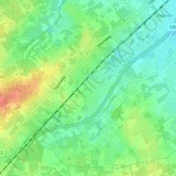
Name: Sint-Joris topographic map, elevation, terrain.
Location: Sint-Joris, Alken, Tongeren, Limburg, Vlaanderen, 3570, België (50.85198 5.25230 50.89198 5.29230)
Average elevation: 49 m
Minimum elevation: 33 m
Maximum elevation: 79 m
Other topographic maps
Click on a map to view its topography, its elevation and its terrain.