
Savage River topographic map
Interactive map
Click on the map to display elevation.
About this map
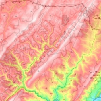
Name: Savage River topographic map, elevation, terrain.
Average elevation: 687 m
Minimum elevation: 220 m
Maximum elevation: 921 m
Other topographic maps
Click on a map to view its topography, its elevation and its terrain.
Bloomington
United States > Maryland > Garrett County > Bloomington
Bloomington, Garrett County, Maryland, 21523, United States
Average elevation: 405 m