
Aguanish topographic map
Interactive map
Click on the map to display elevation.
About this map
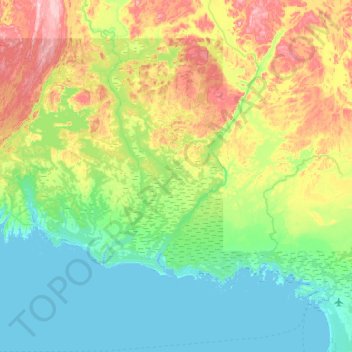
Name: Aguanish topographic map, elevation, terrain.
Location: Aguanish, Minganie, Côte-Nord, Quebec, Canada (50.20844 -62.54764 50.46781 -61.90069)
Average elevation: 65 m
Minimum elevation: -2 m
Maximum elevation: 229 m
Other topographic maps
Click on a map to view its topography, its elevation and its terrain.
Lac Costebelle
Canada > Quebec > Aguanish > Aguanish
Lac Costebelle, Aguanish, Minganie, Côte-Nord, Quebec, Canada
Average elevation: 63 m