
Wedza topographic map
Interactive map
Click on the map to display elevation.
About this map
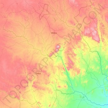
Name: Wedza topographic map, elevation, terrain.
Location: Wedza, Mashonaland East Province, Zimbabwe (-19.12571 31.19691 -18.41039 31.98539)
Average elevation: 1,274 m
Minimum elevation: 817 m
Maximum elevation: 1,789 m
Other topographic maps
Click on a map to view its topography, its elevation and its terrain.
Uzumba-Maramba-Pfungwe
Zimbabwe > Mashonaland East Province
Uzumba-Maramba-Pfungwe, Mashonaland East Province, Zimbabwe
Average elevation: 931 m