
Long Bay topographic map
Interactive map
Click on the map to display elevation.
About this map
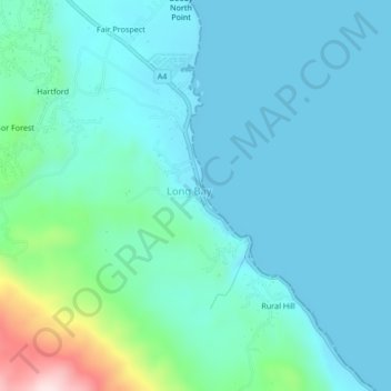
Name: Long Bay topographic map, elevation, terrain.
Location: Long Bay, Portland, Surrey County, Jamaica (18.08549 -76.33827 18.12549 -76.29827)
Average elevation: 63 m
Minimum elevation: 0 m
Maximum elevation: 393 m