
Shefford topographic map
Interactive map
Click on the map to display elevation.
About this map
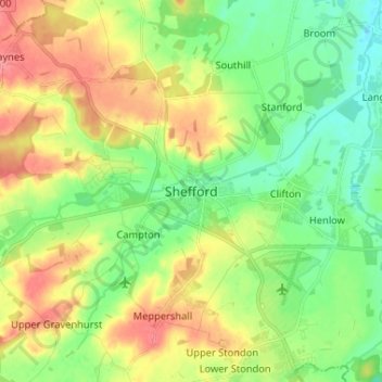
Name: Shefford topographic map, elevation, terrain.
Average elevation: 54 m
Minimum elevation: 26 m
Maximum elevation: 94 m
Other topographic maps
Click on a map to view its topography, its elevation and its terrain.
Shefford
United Kingdom > England > Shefford
Shefford, Central Bedfordshire, East of England, England, United Kingdom
Average elevation: 50 m