
Shediac Bridge topographic map
Interactive map
Click on the map to display elevation.
About this map
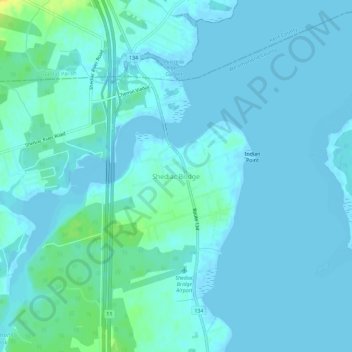
Name: Shediac Bridge topographic map, elevation, terrain.
Average elevation: 4 m
Minimum elevation: -2 m
Maximum elevation: 26 m
Other topographic maps
Click on a map to view its topography, its elevation and its terrain.
Shediac
Canada > New Brunswick > Shediac Parish
Shediac, Shediac Parish, Westmorland County, New Brunswick, Canada
Average elevation: 17 m
Saint-Philippe
Canada > New Brunswick > Shediac Parish
Saint-Philippe, Shediac Parish, Westmorland County, New Brunswick, Canada
Average elevation: 25 m