
Radium Springs topographic map
Interactive map
Click on the map to display elevation.
About this map
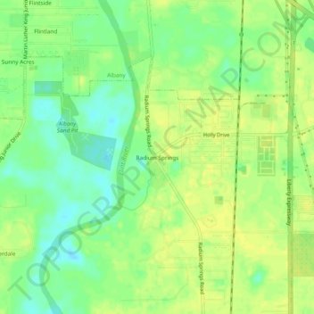
Name: Radium Springs topographic map, elevation, terrain.
Location: Radium Springs, Dougherty County, Georgia, 31705, USA (31.50629 -84.15546 31.54629 -84.11546)
Average elevation: 57 m
Minimum elevation: 45 m
Maximum elevation: 64 m