
Dodgeville topographic map
Interactive map
Click on the map to display elevation.
About this map
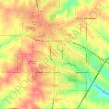
Name: Dodgeville topographic map, elevation, terrain.
Location: Dodgeville, Iowa County, Wisconsin, United States (42.94524 -90.15090 42.98898 -90.10826)
Average elevation: 369 m
Minimum elevation: 315 m
Maximum elevation: 401 m
Other topographic maps
Click on a map to view its topography, its elevation and its terrain.
Mineral Point
United States > Wisconsin > Iowa County > Mineral Point
Mineral Point, Iowa County, Wisconsin, United States
Average elevation: 324 m