
Arad topographic map
Interactive map
Click on the map to display elevation.
About this map
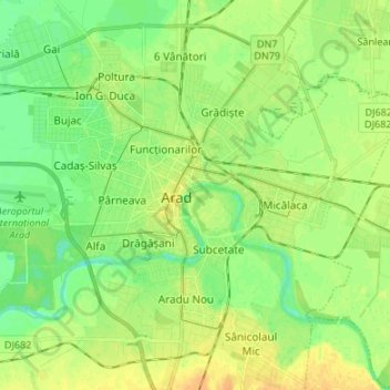
Name: Arad topographic map, elevation, terrain.
Location: Arad, Romania (46.12930 21.26348 46.22219 21.37644)
Average elevation: 111 m
Minimum elevation: 99 m
Maximum elevation: 123 m
Other topographic maps
Click on a map to view its topography, its elevation and its terrain.