
Klagenfurt topographic map
Interactive map
Click on the map to display elevation.
About this map
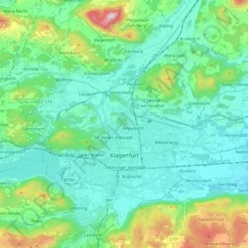
Name: Klagenfurt topographic map, elevation, terrain.
Location: Klagenfurt, Carinthia, Austria (46.57438 14.21028 46.70868 14.41626)
Average elevation: 531 m
Minimum elevation: 407 m
Maximum elevation: 1,004 m