
Strabane topographic map
Interactive map
Click on the map to display elevation.
About this map
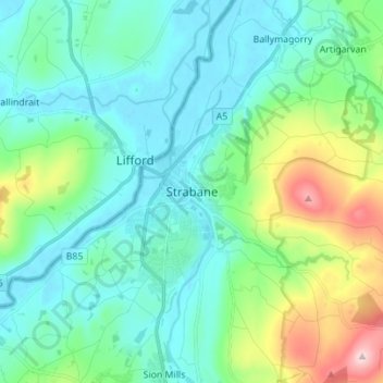
Name: Strabane topographic map, elevation, terrain.
Average elevation: 71 m
Minimum elevation: -1 m
Maximum elevation: 327 m
Other topographic maps
Click on a map to view its topography, its elevation and its terrain.
Churchill
Royaume-Uni > Irlande du Nord > Comté de Tyrone
Churchill, Comté de Tyrone, Ulster, Irlande du Nord, BT82 0PH, Royaume-Uni
Average elevation: 96 m